Corrupted absolute vorticity from new RRFS 3 km grid #471
Comments
|
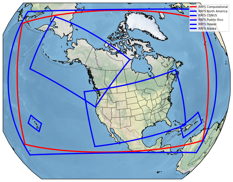
@EricRogers-NOAA, are there points within the new write component grid that lie outside the ESG computation grid? I'm wondering if UPP is correctly configured to ignore absolute vorticity for undefined write component grid points. We did not have undefined write component grid points in the old grid. |
|
@JeffBeck-NOAA Yes there is; see . Outer blue line is the rotated lat/lon grid and the red line is the new compute domain. But didn't the old 3 km N. America rotated lat/lon grid also have points outside the ESG domain? (see https://www.emc.ncep.noaa.gov/users/Eric.Rogers/miscfiles/oldrrfs3km.png) |
|
@EricRogers-NOAA, sorry, I was thinking of the 3-km CONUS domain. Yes, the old NA 3-km write component domain also had undefined points. Was absolute vorticity confirmed to be working with that domain? |
|
Yes, it looks good. |
|
OK, I know that individual variables have had these unrealistic values in UPP before when undefined points existed in the output grid. Whether that also depends on the unique grid, I'm not sure. That may not be what's going on here, though. |
|
@JeffBeck-NOAA We incorporate the changes of restricting undefined grids involved in ABSV computation UPP/sorc/ncep_post.fd/CALVOR.f Line 330 in 40fbb3f From my debugging, it seems the grids with extreme values of ABSV have DX/DY close to 0 in routine dvdxdudy. The computation of DX/DY can be found at Should we expect two grids with same lat/lon values in the new 3 km N. America rotated lat/lon grids? |
|
It appears to me in the new North American domain ((4881 X 2961), these grids with extreme ABSV values have dx/dy close to 0., Here are some printouts for points with dx/dy=0. : UPP read lat/lon from model outputs. Would we expect neighbor grids with the same lat/lon in rotated lat/lon grids? @JeffBeck-NOAA @EricRogers-NOAA @junwang-noaa |
|
@JeffBeck-NOAA @EricRogers-NOAA Wen made more test runs with debug prints. UPP reads lat/lon from model output thus we suspect there maybe an issue with model writing out lat/lon?
|
|
Wen and I will update UPP to use vorticity from a neighbor point when dx or dy is zero. |
|
@EricRogers-NOAA @JacobCarley-NOAA I think we identified the culprit of vorticity issues. It is the final term in ABSV(I,J) = DVDX - DUDY + F(I,J) + UAVG*TAN(GDLAT(I,J)*DTR)/ERAD , where the Tangent of Poles go to infinity. It appears that GSL discovered this issue with their RAP domain crossing over the North Pole and as such they removed this final term in their vorticity calculation in UPP subroutine https://github.com/NOAA-EMC/UPP/blob/develop/sorc/ncep_post.fd/CALVOR.fIF(MODELNAME == 'RAPR') then
|
|
@HuiyaChuang-NOAA this is great news! Thank you for your work on this. I agree with using the GSL formulation for all models. |
|
Thanks for your help tracking this down, @HuiyaChuang-NOAA! |
|
Not for the global models please. |
|
@SMoorthi-emc The global models are using another option. See https://github.com/NOAA-EMC/UPP/blob/develop/sorc/ncep_post.fd/CALVOR.f#L77 |
|
I know, I wrote that code |
|
The changes proposed by @HuiyaChuang-NOAA was committed in the branch https://github.com/WenMeng-NOAA/UPP/tree/post_rrfs_absv |
|
Thank you all for your feedback. Thank you @WenMeng-NOAA for committing the changes quickly. @EricRogers-NOAA @JacobCarley-NOAA @EricJames-NOAA @JeffBeck-NOAA |
|
@WenMeng-NOAA @HuiyaChuang-NOAA @JacobCarley-NOAA: I ran a test of Wen's post_rrfs_absv UPP code with sample history files from the 3km RRFS N. American domain run. I think there is still a problem with the absolute vorticity. From the PRSLEV file on the rotated lat/lon grid: 2:9426651:vt=2022052608:500 mb:1 hour fcst:ABSV Absolute Vorticity [1/s]: I have three plots of the 500 mb ABSV field from this test online, go to https://www.emc.ncep.noaa.gov/users/Eric.Rogers/post_rrfs_absv_tests/files.php
I am rerunning the forecast test with a reduced rotated lat/lon output grid that does not cross the North Pole to see if the absolute vorticity from this run looks OK from Wen's post_rrfs_absv UPP branch. I expect that it will. |
Eric, my modification to UPP CALVOR.f is slightly different than Wen's that I simply commented out the final term My output is in /gpfs/dell2/ptmp/Hui-Ya.Chuang/post_fv3r_2022033112/ and you can see 500 mb absv is reasonable: 1302:7158581186:vt=2022033115:500 mb:3 hour fcst:ABSV Absolute Vorticity [1/s]: I will check out Wen's branch and run the test case Wen gave me and let you know how it goes. Huiya |
|
Thank you Hui-ya. I added one more image to that directory, if you go to https://www.emc.ncep.noaa.gov/users/Eric.Rogers/post_rrfs_absv_tests/files.php I now have https://www.emc.ncep.noaa.gov/users/Eric.Rogers/post_rrfs_absv_tests/500vort_full_reducedgrid.png. This was made with Wen's branch with a reduced-sized RRFS output grid that does not cross the North Pole. As you can the absolute vorticity looks OK. I have saved the dynf001.nc and phyf001.nc files from my full domain forecast test if you or Wen want to run a test with them. |
Eric, I checked out post_rrfs_absv branch but didn't see the vorticity fix in it. I believe Wen only committed the fix in her fork. Wen is on leave till Thursday. If you point me at your version of code, I will be happy to make one line fix and send it back to |
|
@HuiyaChuang-NOAA the code I was testing last week is at /gpfs/dell6/emc/modeling/noscrub/Eric.Rogers/fv3lam_for_dellp3.5/sorc/post_rrfs_absv. Thanks. |
|
The branch post_rrfs_absv was updated with some modifications of dx/dy computation from Huiya. Wen's test results can be found at /u/Wen.Meng/ptmp/post_fv3r_2022033112 on Venus. @EricRogers-NOAA Can you download the latest version of post_rrfs_absv and have a test? Thanks! |
|
@WenMeng-NOAA Thanks, but I'm afraid we're not there yet. See these two plots of 1-h forecast 500 mb HGT and ABSV from a recent RRFS forecast, from GRIB2 files made with the latest post_rrfs_abvs code: https://www.emc.ncep.noaa.gov/users/Eric.Rogers/upptests/500mb.png (full domain) Here are the WGRIB2 inventory numbers: Full domain: |
@EricRogers-NOAA It seems the magnitude are still too larger. I have RRFS baseline with domain not over north pole:@HuiyaChuang-NOAA Do you have comments? |
|
@EricRogers-NOAA At some point, the variable lon/lat in FV3R output was changed to earth latlon. Since UPP uses these earth |
|
Using dlat/dlon to compute dx/dy for rotated latlon grid produces reasonable vorticity. |

|
@EricRogers-NOAA I incorporated the new changes from @HuiyaChuang-NOAA. The test is at /u/Wen.Meng/ptmp/post_fv3r_2022033112 on mars. Could you please verify them? Thanks! |
|
@WenMeng-NOAA I took your PRSLEV file and ran my wgrib2 interpolation job to the display grid and then ran my Grads plot script, attached is a plot of 500mb Z, ABSV over the entire domain. As you can see the 500 mb ABSV field looks realistic now. Thanks!
|

|
@EricRogers-NOAA Thanks for verifying. I will create a new branch based on UPP 2D decomposition structure and incorporate the ABSV fix. I might ask you to verify my new test again. |
|
@EricRogers-NOAA thank you for helping us verify the output. @WenMeng-NOAA once you create a new branch from new 2D decomposed develop, I will be happy to update it with vorticity fix |
|
@EricRogers-NOAA A new branch post_rrfs_absv_new was created including ABSV fix. My test is at /u/Wen.Meng/ptmp/post_fv3r_2022033112 on Venus. Would you please verify them? Thanks! |
|
@WenMeng-NOAA The 500 mb ABSV looks fine in your latest test, thanks:
|

|
@EricRogers-NOAA I conducted the UPP RT test for RRFS which has the domain not across north pole. Here are some changed results due to the fixes including modification of dx/dy for rotated latlon grids and one term removed in ABSV computation (RAP approach) : If you would like to evaluate, the tests are:
Please let me know if you have concerns/suggestions. |
|
@BinLiu-NOAA We have working on the ABSV issue in RRFS which has domain across north pole. From my UPP RT test, the HAFS baseline has the following changes in ABSV due to the fix including ABSV computation modification (one term removed for regional FV3): Please let me know if you have concerns/suggestions. |
|
@EricRogers-NOAA and @BinLiu-NOAA If you would like to run your tests, the working branch is at |
Good to see differences are limited to the fields that involve horizontal derivatives. Also, I'm actually a bit surprised how high the correlations are which is re-assuring. Guess the curvature term we removed from vorticity computation is small. |
|
@WenMeng-NOAA There is no "/u/Wen.Meng/ptmp/fv3r_2022030200 " on venus |
I believe Wen meant on Mars |
|
@EricRogers-NOAA Yes, it is Mars. Sorry for typo. |
|
@HuiyaChuang-NOAA I agree that the correlation numbers look reassuring. I plotted the 2-5 km UPHL field from the baseline and test run over the NW CONUS; Differences but nothing earthshattering. It's usually the 1-h MAX 2-h km UPHL that severe weather folks look at over the instantaneous field anyway. I will review/approve the PR momentarily. Thanks all for getting this fixed! |


@WenMeng-NOAA, sorry for the late reply. I somehow missed this Github issue discussion. I have just discussed with @LinZhu-NOAA, and these minor differences look reasonable to us. And the thanks for fixing this ABSV issue! In the meantime, as @JiliDong-NOAA mentioned in another email thread, there is also another issue for the regional latlon grid when the domain crosses the primary meridian (zero longitude). The DYVAL calculation is problematic, leading to wrong longitude range and resolution in the UPP output grib2 files. @LinZhu-NOAA and I tested the fix suggested by @JiliDong-NOAA: which worked and fixed this issue. We were wondering whether or not you want to include this fix in the PR#516 as well. Or maybe, you would prefer to fix this issue in another PR. Thanks! |
|
@BinLiu-NOAA Thanks for clarifying.
Would you submit this hafs related fix in a new UPP PR? |
Thanks, @WenMeng-NOAA! Sure, I will coordinate with @LinZhu-NOAA and @JiliDong-NOAA so that they can help to submit a separate PR fixing this regional latlon grid crossing the prime meridian issue. Thanks! |
|
Eric, I did see the fix in the subroutine to compute vorticity but we also
need another fix to prevent dx from becoming zeros at
the poles. One alternative is to compute dx/dy using rotated latlon. I am
talking to HAFS group to see why they updated UPP
to use earth latlon to compute dx/dy at one point.
…On Tue, May 31, 2022 at 10:16 AM EricRogers-NOAA ***@***.***> wrote:
@HuiyaChuang-NOAA <https://github.com/HuiyaChuang-NOAA> the code I was
testing last week is at
/gpfs/dell6/emc/modeling/noscrub/Eric.Rogers/fv3lam_for_dellp3.5/sorc/post_rrfs_absv.
Thanks.
—
Reply to this email directly, view it on GitHub
<#471 (comment)>, or
unsubscribe
<https://github.com/notifications/unsubscribe-auth/ANQZ2VH4KKKTSLVKKTSCGILVMYNLDANCNFSM5SQWWALA>
.
You are receiving this because you were mentioned.Message ID:
***@***.***>
--
--------------------------------------------------------------
Physical Scientist
Environmental Modeling Center, NCEP, NWS, NOAA
301-683-3716
Office 2068
5830 University Research Court
College Park. MD 20740
|
|
Can we check if the issue is also shown up in the standalone post?
@EricRogers-NOAA <https://github.com/EricRogers-NOAA> Can you check how the
center/orientation for these grids are chosen? If it is true that the grid
points are very close (dx~0, dy~0), maybe we can consider updating the
computation for ABSV.
…On Wed, Apr 6, 2022 at 9:21 AM HuiyaChuang-NOAA ***@***.***> wrote:
@JeffBeck-NOAA <https://github.com/JeffBeck-NOAA> @EricRogers-NOAA
<https://github.com/EricRogers-NOAA> Wen made more test runs with debug
prints.
It appeared that latitudes and longitudes are nearly identical between two
neighboring points at the grid points with dx/dy=0. Please see example
below dashed lines and the values represent
i,j,dx,dy,gdlon(i+1,j),gdlon(i,j),gdlat(i,j+1),gdlat(i,j)
UPP reads lat/lon from model output thus we suspect there maybe an issue
with model writing out lat/lon?
Is this something Jeff can check on? or do we need to open an issue with
UFS model?
1818 2921 2.239053 0.0000000E+00 147.9776 147.9775 77.29437 77.29437
—
Reply to this email directly, view it on GitHub
<#471 (comment)>, or
unsubscribe
<https://github.com/notifications/unsubscribe-auth/AI7D6TIOARCMYXAWQIJPQADVDWFWNANCNFSM5SQWWALA>
.
You are receiving this because you were mentioned.Message ID:
***@***.***>
|
* GOES-18 has been opertaion since Jan 4, 2023.
Update scripts for GVF to use both v2r3 and v3r0 NPP GVF observations.
Add 272 in convinfo for monitoring 272 AMV winds.
Since the LAMDAX parallel, running the RRFS N. America 3 km domain, switched to a new compute/output grid last week, the absolute vorticity in the GRIB2 rotated lat/lon grid coming out on the inline post is incorrect, two examples:
453:2573786274:vt=2022040522:500 mb:34 hour fcst:ABSV Absolute Vorticity [1/s]:
ndata=14452641:undef=2194473:mean=-0.00456186: min=-55920:max=0
grid_template=1:winds(N/S):
rotated lat-lon grid:(4881 x 2961) units 1e-06 input WE:SN output WE:SN res 48
lat -37.000000 to 37.000000 by 0.025000
lon 299.000000 to 61.000000 by 0.025000 #points=14452641
south pole lat=-35.000000 lon=247.000000 angle of rot=0.000000
256:1404000287:vt=2022040612:200 mb:60 hour fcst:ABSV Absolute Vorticity [1/s]:
ndata=14452641:undef=2194473:mean=0.00507417:min=0:max=62200
grid_template=1:winds(N/S):
rotated lat-lon grid:(4881 x 2961) units 1e-06 input WE:SN output WE:SN res 48
lat -37.000000 to 37.000000 by 0.025000
lon 299.000000 to 61.000000 by 0.025000 #points=14452641
south pole lat=-35.000000 lon=247.000000 angle of rot=0.000000
The text was updated successfully, but these errors were encountered: