-
Notifications
You must be signed in to change notification settings - Fork 0
7. Preparing Road Shapefile
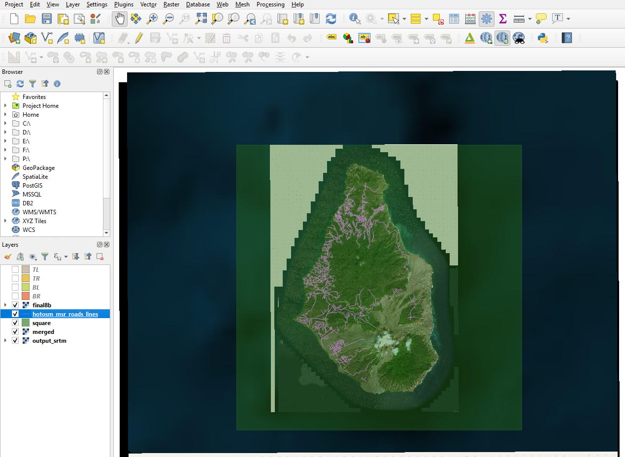
Load into QGIS (drag and drop) road shapefile
In this example I got a good dataset from - https://data.humdata.org/
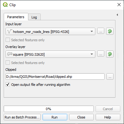
Clip vector to square shape Top Menu - Vector > Geoprocessing Tools > Clip
Save features from clip to new shapefile - selecting appropriate CRS, in this example CRS UTM-20
Top Menu - Layer > Save As
Set road shapefile to CRS - 31N
RMB on road shapefile > Set CRS > Set Layer CRS
Set QGIS project CRS to UTM- 31N (bottom right corner):
Collect extents from your square shapefile:
Extent: (576787.687480, 1841104.815839) - (597267.687480, 1861584.815839)
The first two values will be used in the v.transform step below.
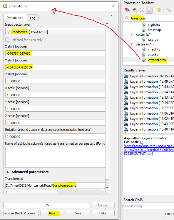
v.transform on road shapefile using calculated extents from square shapefile
Your heightmap asc must adhere to Terrain Builders required values of easting 200000 and northing 0 Your road shapefile also needs to line up to the same values - we will use v.transform to achieve this
So taking the extent values we grabbed in previous step -
We will do the following calculations to bring these values to (200000 and 0):
Easting: 576787.687480 - 376787.68748 = 200000
Northing: 1841104.815839 - 1841104.815839 = 0
-376787.68748
-1841104.815839
Having figured out the correct figures plug them into the v.transform process
Drag and Drop into QGIS your heightmap asc - the one you are able to load into Terrain builder - already adjusted to (200000, 0)
Set CRS on above asc to UTM - 31N
Right click on asc in Layers > Zoom to Layer
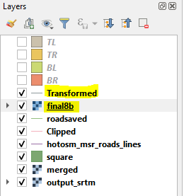
In Layers panel drag the asc below your transformed road shapefile - so you can see the roads layered above the asc
Your roads should now be perfectly aligned above your heightmap
RMB on transformed shapefile layer > Toggle Editing
RMB on transformed shapefile layer > Open Attribute Table
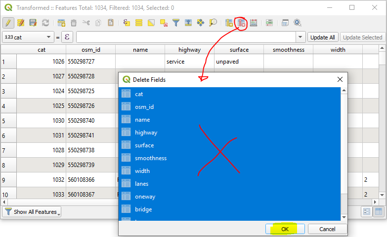
Click Delete field - select all fields and press OK
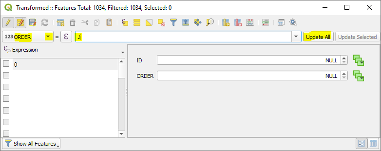
New Field - Name 'ID' - length 0
New Field - Name 'ORDER' - length 0
Toggle - Multi Edit mode
ID - Enter 0 - click Update All
Select ORDER from drop down - Enter 1 - click Update all
Click - Switch to table view
Click Save
RMB on transformed road shapefile - Toggle Editing to save the changes
Switching to Terrain Builder -
Load your road shapefile
Top menu - File > Import > Shapes
Click OK
Perfectly overlaid within Terrain builder:
