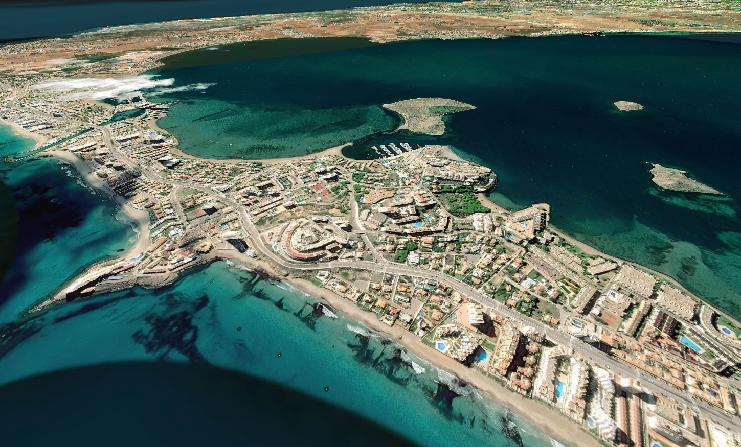
- Library to display maps using
three.js. Allows for full world scale visualization of geographic data using tile based chunks. - Can generate 3D geometry for terrain from terrain height data using software generated tiles or using GPU displacement maps.
- Supports multiple maps service providers (BingMaps, GoogleMaps, HereMaps, MapBox, MapTiler, OpenMapTiles, OpenStreetMaps).
- Each one of these map providers require a developer account and a API configuration to be used.
- Its possible to implement new provides using the
MapProviderinterface. - Providers should have a tile based map system to be supported by the library.
- You can test some live demos of the library running from the project page.
- Some of these examples might require API keys for the map services used.
- To add the library to your project get the library trough NPM alongside with three.js and use it as a ES module.
- You can also include the library directly in you webpage but ensure first that THREE is available globally.
// Create a map tiles provider object
var provider = new OpenStreetMapsProvider();

// Create the map view and add it to your THREE scene
var map = new MapView(MapView.PLANAR, provider);
scene.add(map);

// By default coordinates are to meter, can be resized to kilometer
map.scale.set(0.001, 0.001, 0.001);- The project uses internally a XY EPSG:900913 coordinate format to be compatible with the XYZ coordinates used in three.js
- Use the
UnitsUtilsclass to access the unit conversion methods for example to convert a latitude, longitude WGS84 pair value to XY coordinates you can use the code bellow:
var coords = Geo.UnitsUtils.datumsToSpherical(40.940119, -8.535589);
controls.target.set(coords.x, 0, -coords.y);-
Tiles are fetched from the service API configured, each one of the services requires specific configuration using the specific
MapProviderobject. -
Base tiles are always loaded at the beginning of the process, then each frame a couple of rays are casted into the tile tree. The number of rays can be configured using the
MapViewsubdivisionRaysattribute. -
The distance of the ray to the camera is used to define if the node needs to simplified or sub-divided. These values can be configured using the
thresholdUpandthresholdDownvalues.
-
The library has support for multiple data providers that must be configured beforehand. Most of these data providers rely on external API that differ from service to service.
-
Each one of them has its own provider object implementation of the
MapProviderinterface. -
The
DebugProviderprovides information about the tiles loaded, shows the zoom level and the coordinates of the tile relative to the origin in that specific level.
- The library includes multiple methods for LOD control, that define how tiles are subdivided or simplified.
- Raycast: uses ray casting determine the distance of the nodes to the camera view, it only considers the nodes inside of the view frustum. It uses random sampling and takes some time to pick all nodes to be subdivided but is overall faster.
- Radial: Calculates the distance from the camera to each one of the nodes, the nodes closer are subdivided and nodes far away are simplified a simple and effective method that considers all nodes, and provides a more consistent result.
- Frustum: Similar to the radial mode but only nodes inside of the view frustum are considered for subdivision.
- Custom
LODControlcan be implemented by extending theLODControlobject and implementing theupdateLOD(view, camera, renderer, scene)method.
export class DistanceLOD extends LODControl
{
	constructor() {super();}

	updateLOD(view, camera, renderer, scene)
	{
        // Get world position of the camera.
        var pov = new Vector3();
        camera.getWorldPosition(pov);

        view.traverse(function(node)
        {
            // Check if child in a MapNode
            if(node instanceof MapNode)
            {
                var position = new Vector3();
                node.getWorldPosition(position);

                // Distance between camera and tile
                var distance = pov.distanceTo(position);

                // Normalize distance based on tile level
                distance /= Math.pow(2, 20 - node.level);

                // If closer than X subdivide
                if (distance < 50)
                {
                    node.subdivide();
                }
                // If far away, simplify parent
                else if (distance > 200 node.parentNode)
                {
                    node.parentNode.simplify();
                }
            }
        });
	}
}MapNodeobjects are used to define how the tiles should be represented in the space.MapNodeare organized hierarchically, every node implements the MapNode class that is based on the THREE.Mesh class (every map node has a visual representation as a mesh).- The library has support for both planar and spherical representation of tiles. Most providers only have planar tiles available.
- It is required that the tiles for spherical mode are previously adjusted, since planar tiles get more stretched as closer you get to the poles.
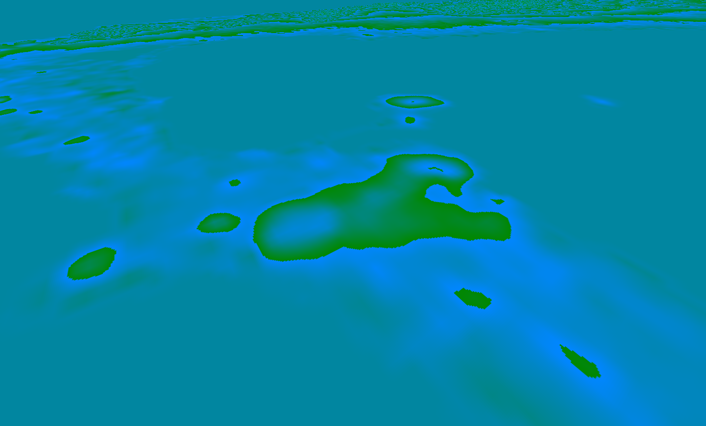
- There are available formats for GPU shader generated geometry using height data directly from the providers.
- GPU generated geometry is more dense, more detailed and a lot faster. But the final geometry used is not accessible for ray casting, so interaction with these geometries is limited.
- On the left the geometry was generated in CPU and on the right the geometry was displaced directly in the vertex shader.
- It is possible to create new data providers to access data other tile sources. New data sources have to provide access to the rasterized tile as a compatible DOM element (e.g. Image, Canvas, ...)
- Custom providers have to extend the base
MapProviderclass and implement thefetchTile(zoom, x, y)method that returns aPromisewith access to the tile data. - Bellow is an implementation of a provider to access OpenStreetMaps tile data using the Tile API the provider simply loads the URL data into a image element.
- These methods are called directly by nodes being loaded into the scene. These should be always asynchronous and should avoid any blocking actions.
export class OpenStreetMapsProvider extends MapProvider
{
	constructor(address) {super();}

	fetchTile(zoom, x, y)
	{
		return new Promise((resolve, reject) =>
		{
			var image = document.createElement("img");
			image.onload = function(){resolve(image);};
			image.onerror = function(){reject();};
			image.crossOrigin = "Anonymous";
			image.src = "https://a.tile.openstreetmap.org/" + zoom + "/" + x + "/" + y + ".png";
		});
	}
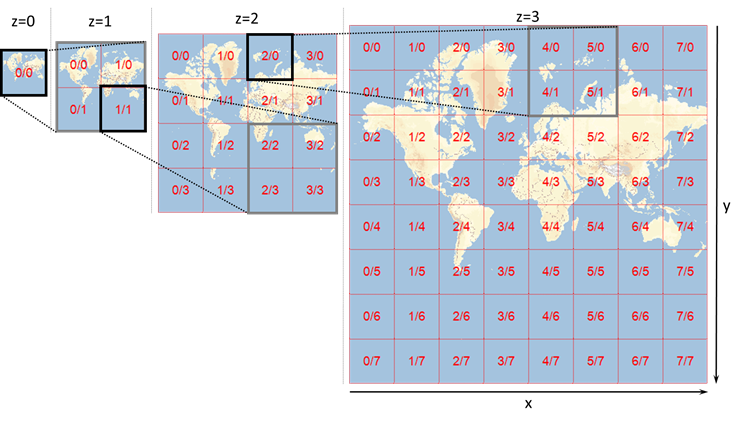
}- Tiles coordinates for each zoom level are counted from the left-top corner sequentially across the tiles.
- Different API's might use different methods to index these tiles (e.g. Bing maps uses a different indexing method).
- These coordinates need to be adapted to ensure correct loading when using this library.
- It is also possible to create fictional tiles without any external API to generate tiles by writing data directly into a canvas or even using a local image database to draw the map.
- The code bellow shows how to implement a tile provided that draws a gradient from blue to red based on the zoom level of the tile with 16x16 pixels. This example can be used as basis for other code based tile generators.
import {Color} from "three";

export class BlueToRedProvider extends MapProvider
{
	fetchTile(zoom, x, y)
	{
		const canvas = new OffscreenCanvas(16, 16);
		const context = canvas.getContext('2d');

		const blue = new Color(0x0000FF);
		const red = new Color(0xFF0000);
		const color = blue.lerpHSL(red, (zoom - this.minZoom) / (this.maxZoom - this.minZoom));

		context.fillStyle = color.getStyle();
		context.fillRect(0, 0, 16, 16);
		return Promise.resolve(canvas);
	}
}- To implement a custom
MapNodewe can create a new class that extends the base implementation. - The objects created from the class should then be passed as argument to the
MapViewobject that is responsible for managing its life cycle. - All map nodes are based on three.js
Meshobject and have attached a Geometry and Material used to render them into the scene. - These materials and geometries can be customized and are not required to be of any specific type. It is recommended to reuse them as much as possible to save memory.
import {SphereGeometry, MeshBasicMaterial, Vector3} from "three";

// The MapNode inherits from three Mesh object and requires a geometry and material
export class CustomMapNode extends MapNode
{
	constructor(parentNode = null, mapView = null, location = MapNode.ROOT, level = 0, x = 0, y = 0)
	{
		super(CustomMapNode.GEOMETRY, CustomMapNode.MATERIAL, parentNode, mapView, location, level, x, y);
	}

	static GEOMETRY = new SphereGeometry(0.5, 32, 32);

	static MATERIAL = new MeshBasicMaterial();

	// Base geometry applied to the map view.
	static BASE_GEOMETRY = new MapNodeGeometry(1, 1, 1, 1);

	// Base scale is applied to the map view
	static BASE_SCALE = new Vector3(UnitsUtils.EARTH_PERIMETER, 1, UnitsUtils.EARTH_PERIMETER);

	initialize() {
		// Method to initialize data of the node (e.g fetch assets)
	}

	createChildNodes()
	{
		// Method called on subdivision to craete child nodes
	}
}- Project uses a MIT license that allow for commercial usage of the platform without any cost.
- The license is available on the project GitHub page


