Part of the Memory-Efficient I/O-Improved Drainage Analysis System (MIDAS)
Please cite Cho (2025) when you use this algorithm or the r.hydrobasin GRASS addon.
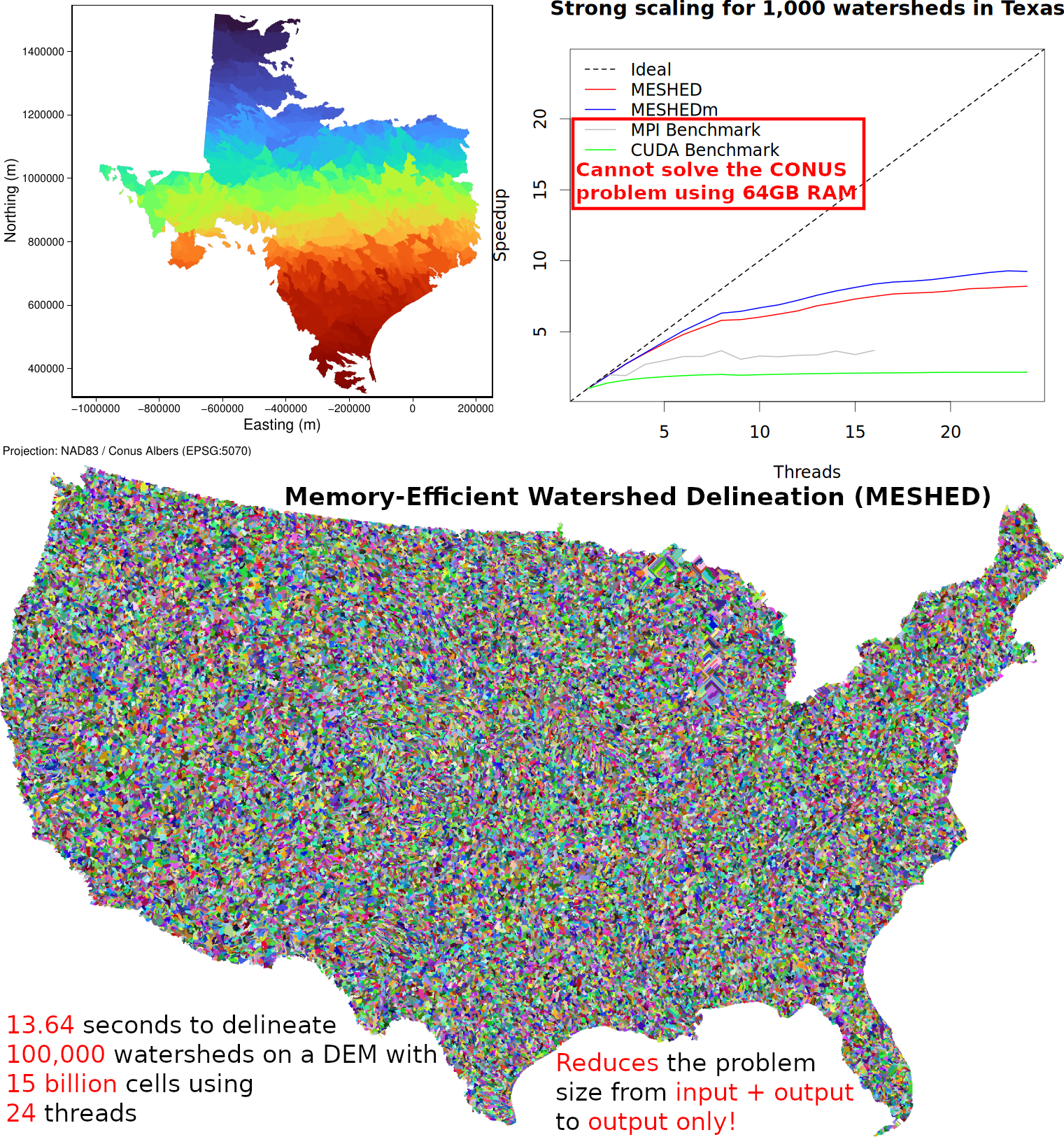
Citation: Huidae Cho, January 2025. Avoid Backtracking and Burn Your Inputs: CONUS-Scale Watershed Delineation Using OpenMP. Environmental Modelling & Software 183, 106244. doi:10.1016/j.envsoft.2024.106244. Author's Version.
Predefined flow direction encodings in GeoTIFF: power2 (default, r.terraflow, ArcGIS), taudem (d8flowdir), 45degree (r.watershed)


Custom flow direction encoding is also possible by passing -e E,SE,S,SW,W,NW,N,NE (e.g., 1,8,7,6,5,4,3,2 for taudem).
For Windows, use MSYS2 and OSGeo4W to install GCC and GDAL, respectively.
makeTest data is available at https://data.isnew.info/meshed.html.
cd test
pretest_TX.bat
test_TX.batcd test
./pretest_TX.sh
./test_TX.sh